
Mount Owen, overlooking Queenstown on Tasmania’s West Coast, isn’t a mountain that has been high on my list of planned hikes. It, and the surrounding hills, bear the scars of Queenstown’s mining history, which saw the destruction of the covering vegetation, leaving a moonscape appearance. Additionally, the climb to the summit is mostly a road walk, which also lowered my expectations regarding the hike.
However, at 1,146 metres above sea level, it is an Abel. So having some time on my hands in Queenstown before a planned hike of Mt Jukes the following day, I decided to tick it off the list.
As it turned out, the walk was a fair bit more interesting than I’d anticipated—especially once the road ran out and I had to find my way to the actual summit.
The Stats
Distance: 12.5km return
Time: 4 hours
Elevation Gain: 729m
Location
The standard route on AllTrails simply follows the gravel access road from its intersection with the Lyell Highway at Gormanson (the next road west of Gould Street). However, not being particularly keen on spending the entire walk trudging up a road, I started at the Horsetail Falls trailhead a little further southwest along the highway.
Starting at Horsetail Falls
I arrived at the Horsetail Falls trailhead at around 1pm. It was an overcast afternoon with low cloud and some occasional drizzle, but okay enough to set out on the hike.
From the trailhead, the walk starts on a well-formed gravel path, climbing steadily alongside a rocky, scrub-covered slope. Soon, this transitions onto an elevated walkway that is a substantial part of the walk to the falls.
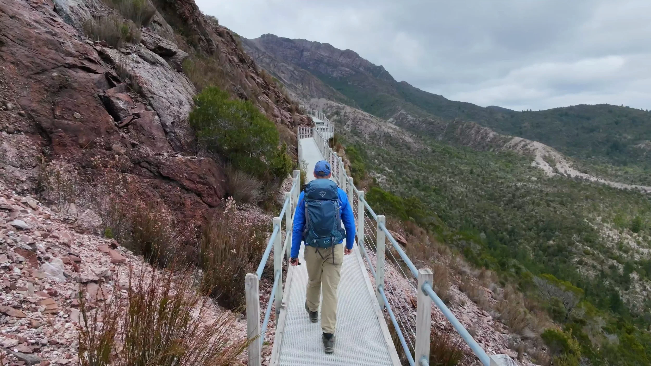
I’ve walked the Horsetail Falls track before, and on previous visits the boardwalk ended at a viewing platform with a railing around it. Heading into this walk, I’d assumed I would have to climb the railing to get onto the rougher track leading to the top of the falls. But the railing is now gone and the constructed walkway reverts to a track along the steep hillside from the old viewing location towards the top of the waterfall.
The Top of Horsetail Falls
Just prior to the falls, the track returns to the raised walkway—where a detour dips down a series of steps to a fenced viewing platform right beside the creek and immediately above the falls.
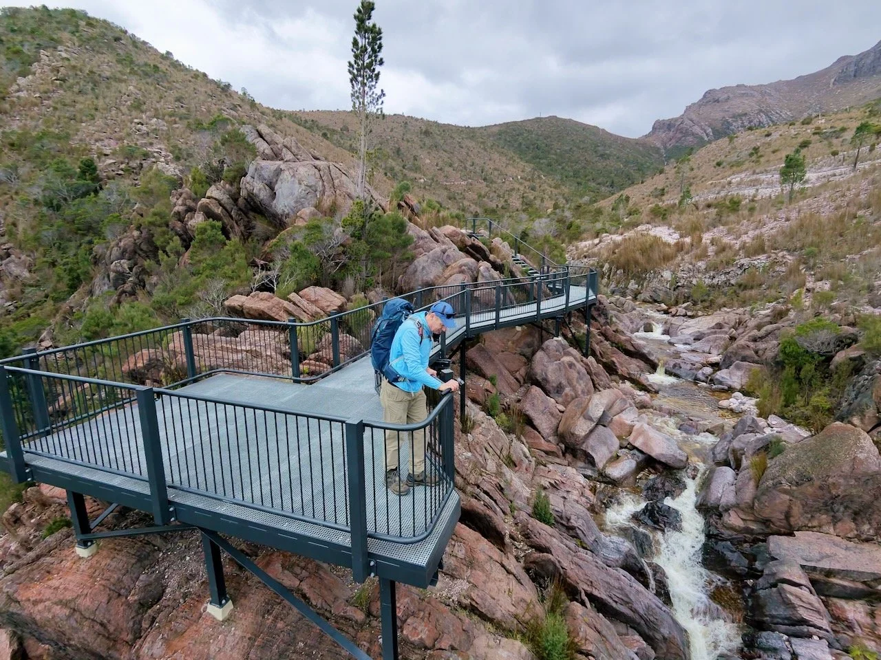
I’d not previously seen the waterfall from this perspective, and it was well worth the short detour. Here, the creek cuts through a narrow gorge of fractured reddish-brown rock, tumbling over boulders and ledges in sheets of white water before plunging over the lip of the cliff into the valley below. Standing right above the drop-off with the water rushing through the rocks below gives a completely different appreciation of the terrain compared to viewing it from further down the valley.
After spending a few minutes taking photos at the top of the falls, I returned to the junction and started climbing towards the Mount Owen road.
Climbing to the Road
From the waterfall, I left the boardwalk behind for a narrower gravel track winding up through low scrub, button grass, and scattered dead timber. The surface here is a mix of compacted red-brown earth, loose gravel, and embedded stones, cutting diagonally across the hillside. This is actually a mountain bike descent track coming down from above, so I kept an ear out for riders coming down the hill. As it turned out, I didn't see anyone.
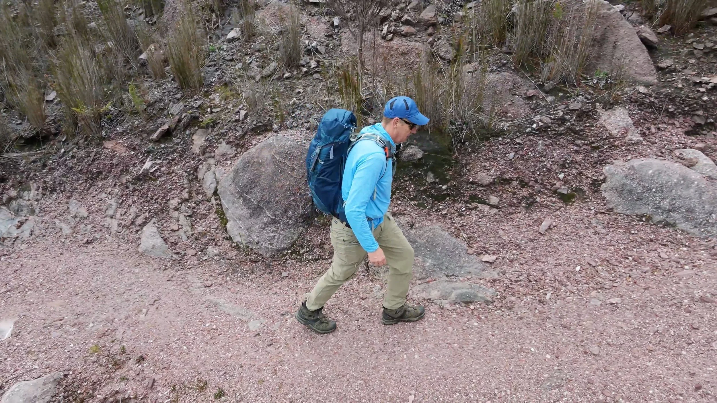
I’d swapped into hiking boots at the car because I expected this section to be wet and muddy, but the track was dry and firm underfoot—I easily could have gotten away with trail runners here, but was grateful for the change in footwear when I got to the summit.
About 40 minutes in, having covered roughly 2km, including the stop at the waterfall, the track popped out onto the wide gravel surface of the Mount Owen access road. From here, the character of the walk changed completely.
The Road Walk
The summit access road is a wide, well-formed, gravel track. While straightforward, the gradient is steep in sections.
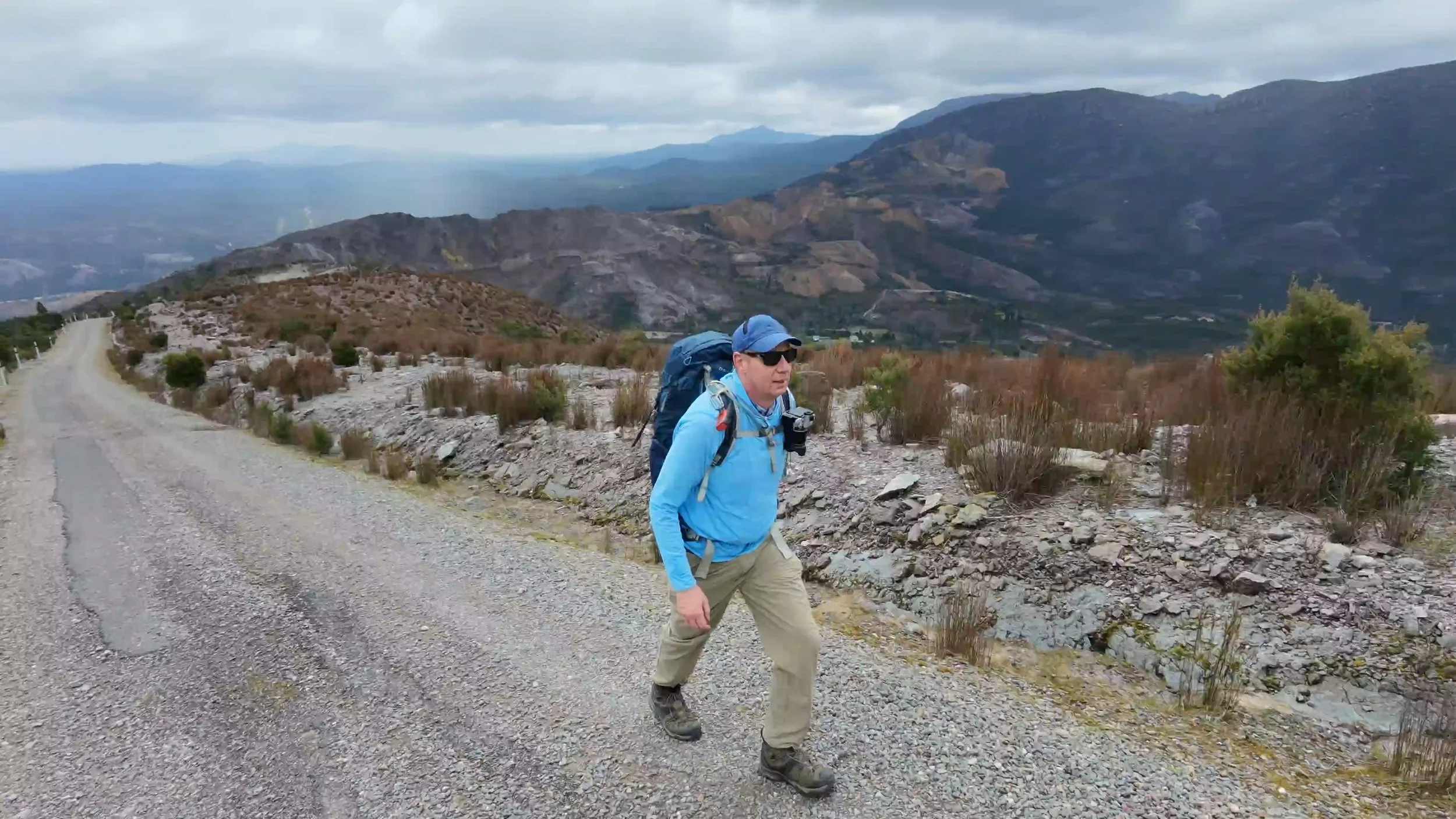
The climb up to the first set of communications towers is relentlessly steep. Flanking the road, the landscape is exposed steep banks of shattered grey-brown rock, patches of low alpine heath, and tufts of button grass.
It’s a solid workout, so I was relieved when the gradient finally eased off for a stretch past the initial radio towers. This elevation also gave my first clear views across the surrounding ranges to Lake Burbury, its waters winding between the distant hills.
Beyond the towers, the road continues winding around the upper mountainside, climbing through a series of long switchbacks. Up here, the vegetation thins out almost entirely, giving way to an increasingly barren, rocky landscape dominated by massive conglomerate boulders.
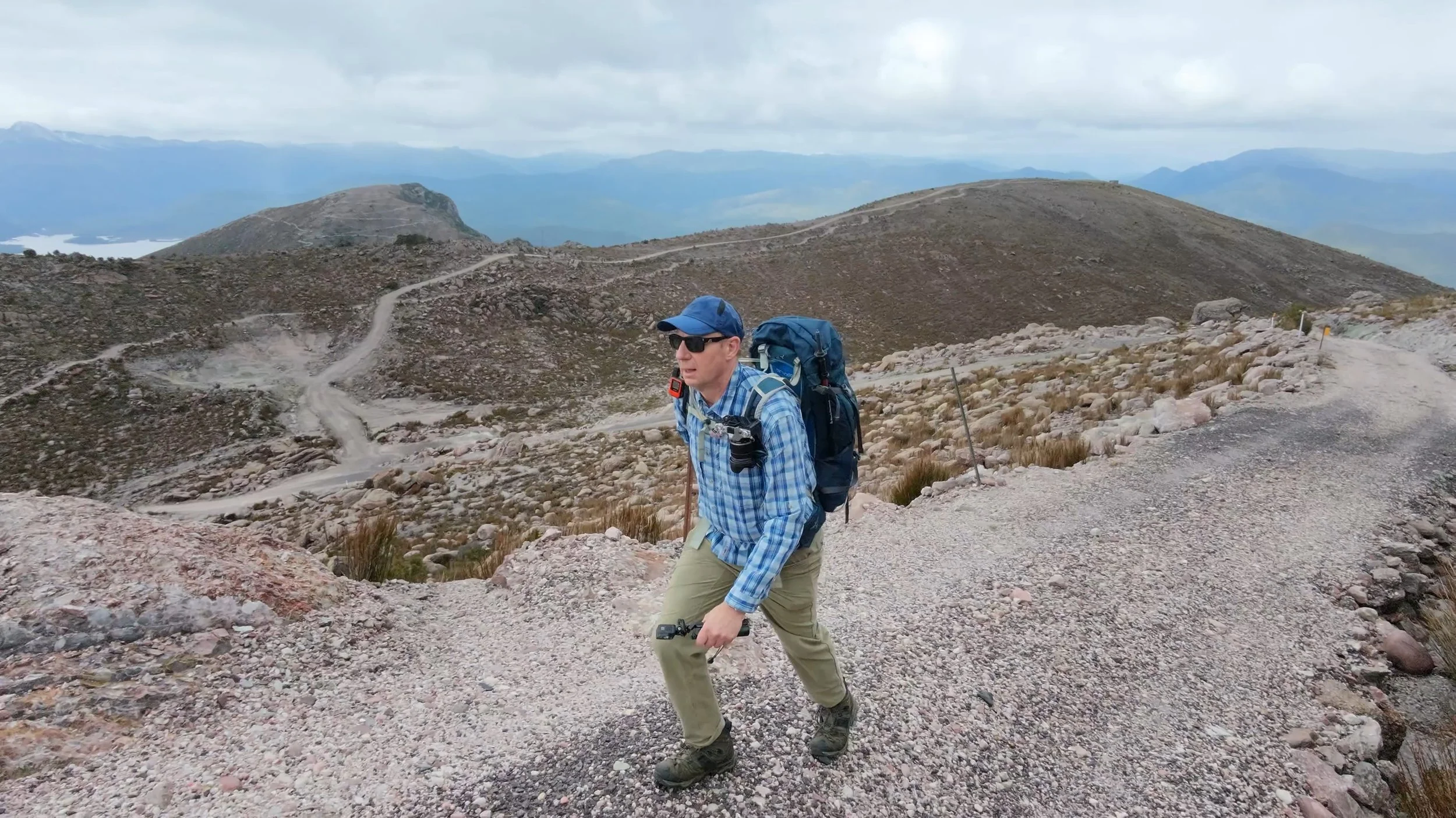
At around an hour and a half in, and 4.5km into the walk, having knocked off several switchbacks, I thought I must be getting close to the top. But every time I rounded a bend, the road kept climbing. Patches of snow began appearing along the rocky verges.
Eventually, the gravel road terminated beside a sheer rock wall and an elevated metal conduit led the way forward.
Finding the Summit
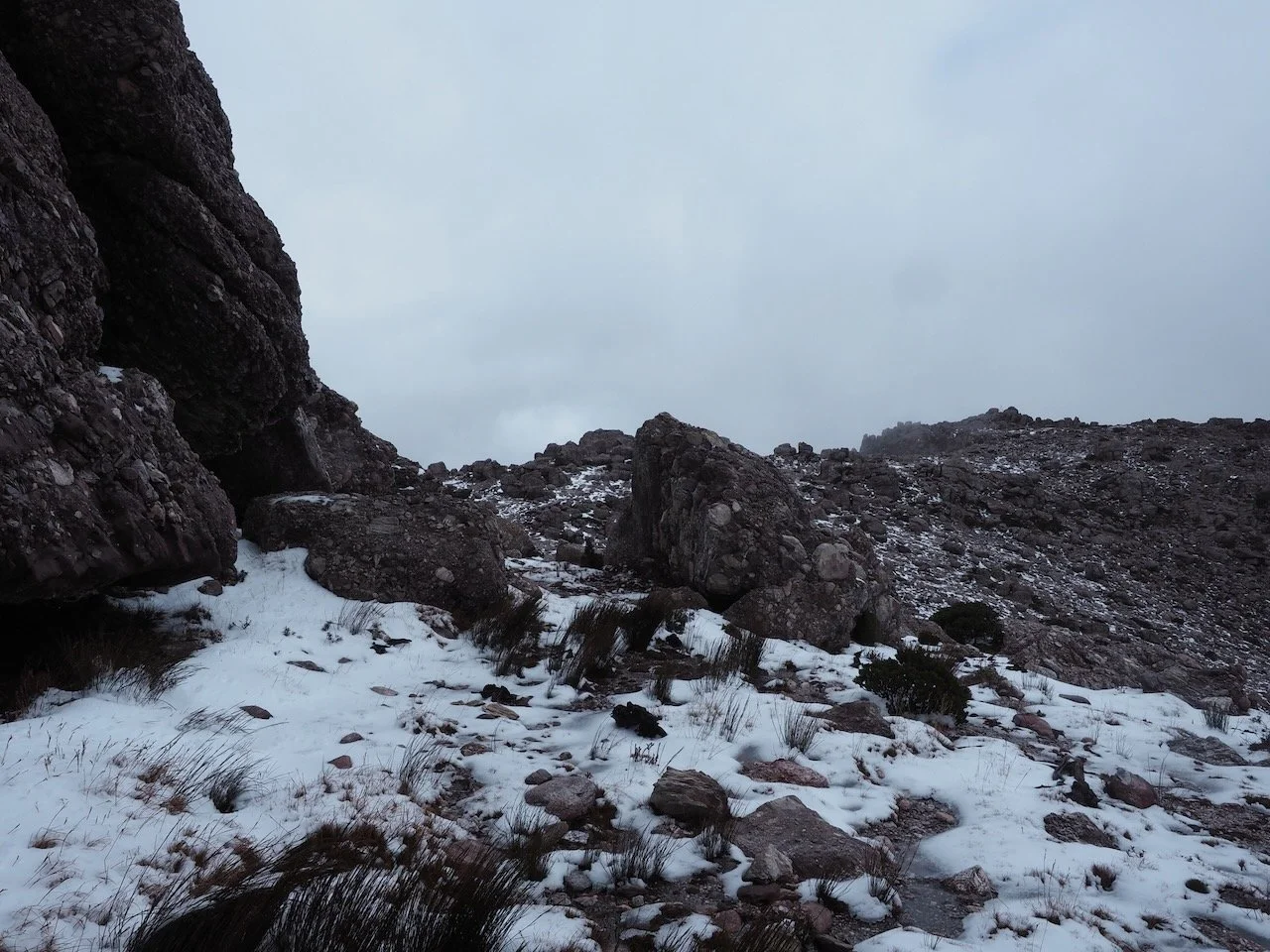
There is no formed track from here. Instead, the route heads straight into a chaotic jumble of giant conglomerate boulders, steep rocky slabs, and patches of button grass. There was a fair bit of snow lying around up here, making the ground slipery, with much of it having turned to ice. With no other footprints in the snow, it was clear I was the only person to come up that day.
I picked my way up through the boulders, at one point having to duck and climb right through a narrow, cave-like gap beneath the overhanging rocks. Shortly after emerging from the rocks, I scrambled up to a high point topped with a large antenna, assuming I’d made it to the summit. But a quick check of my position revealed the true summit was actually further around the ridge.
While I was standing near the antenna, a chunk of ice broke free from the structure and crashed down next to where I was standing.
Retracing my steps down from the antenna outcrop, I found a faint route skirting around the base of the rock bluff I had climbed. With the ground covered in snow and loose scree, keeping an eye out for the occasional rock cairn reassured me I was still on track. I stopped briefly to layer up with a warmer jacket before pushing on.
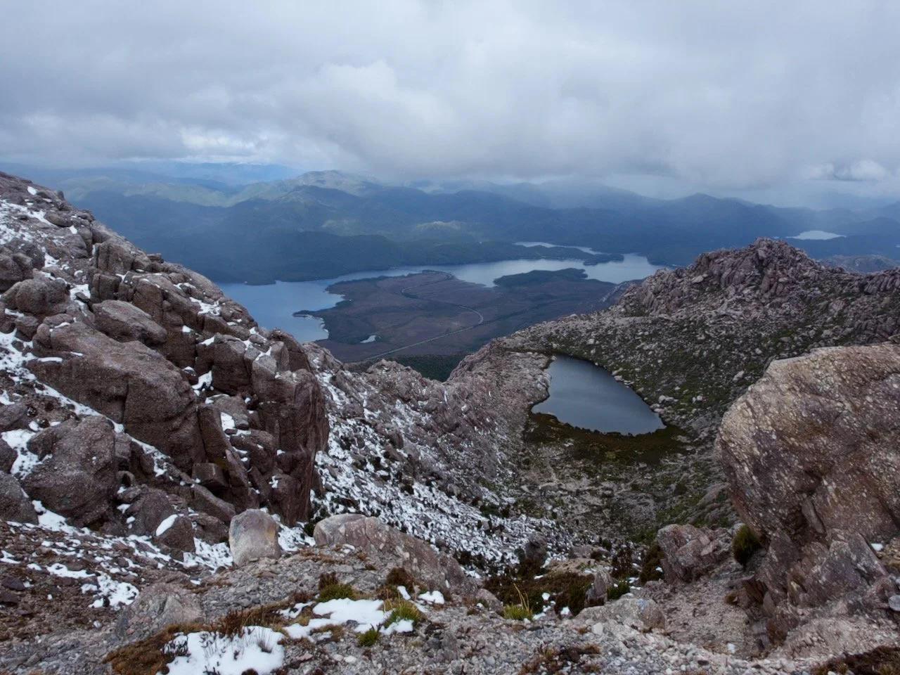
The terrain along this final traverse is spectacular. Towering conglomerate walls rose abruptly on my left, while further ahead the mountainside dropped steeply away towards Lake Burbury and a smaller, dark alpine tarn tucked into a rocky basin directly below the ridge.
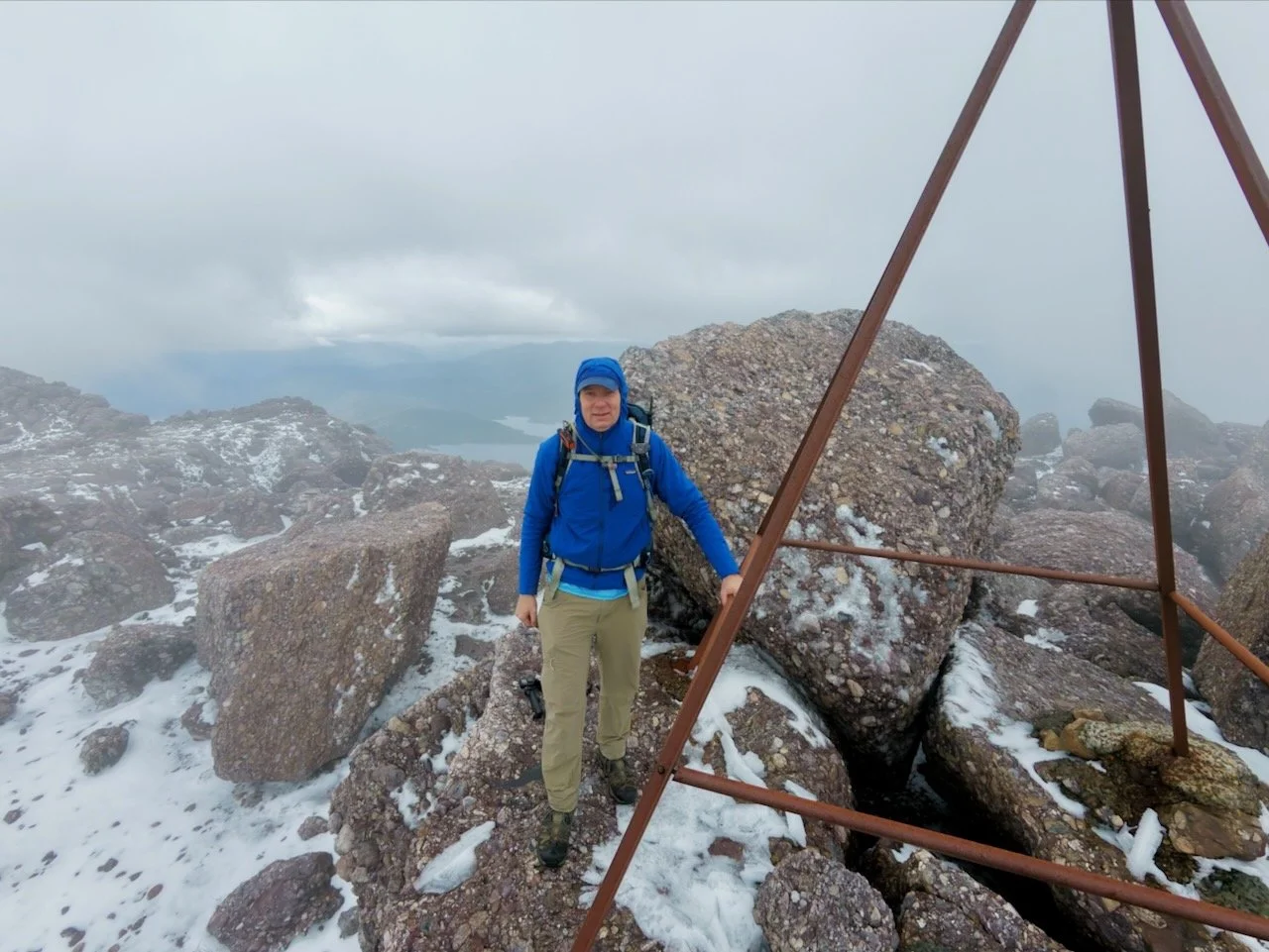
Rounding one last rocky outcrop, the metal-framed trig point finally came into view ahead. After a final short scramble up the icy summit boulders, I was there.
Low cloud was drifting steadily across the peak, swallowing much of the 360-degree panorama. But even so, brief breaks in the mist revealed dramatic glimpses of the snow-dusted ridges dropping away below me and the winding shoreline of Lake Burbury far in the distance. I spent a few minutes at the trig point taking in the atmosphere and grabbing a few photos before starting the descent back to the car.

Final Thoughts
Mount Owen turned out to be a far more rewarding walk than I’d expected. While a large chunk of the climb is a road walk, the steep gradient provides a great workout, and the views across Queenstown and Lake Burbury make the effort worthwhile.
Starting from Horsetail Falls, rather than walking the road from the bottom, is definitely the way to go. The walkway, views at the top of the falls, and the connecting mountain bike track, add a lot of variety to the lower half of the hike.
The real highlight though is the summit ridge above the road end. Navigating the snowy conglomerate boulders, ducking through the rock cave, and spotting the cairns made for a memorable finish. If you’re heading up there, I’d definitely recommend carrying a GPS with the summit marked—the route through the boulders isn't obvious, especially if snow is covering the ground.