
Mt Rogoona & Nescient Peak
Back in December of 2020, Col and I did a hike in the Walls of Jerusalem National Park where we had hoped to summit Mountains of Jupiter. Sadly, we weren’t able to tick this mountain off, so in April of 2025 we planned another trip with the aim of summiting three mountains: Mount Rogoona, Mountains of Jupiter, and Nescient Peak. Unfortunately, Jupiter eluded us again, but we did have a fantastic trip summiting the other two mountains.
Location
The three mountains we were planning to climb are all within the Walls of Jerusalem national park. To get to them, the plan was to hike in on the Lake Myrtle Track from Mersey Forest Road, near Lake Rowallan (about a 4 hour drive from Hobart).
Our Hike
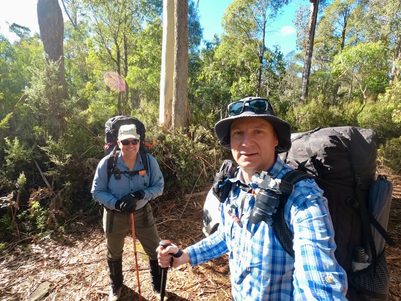
We set out from the Lake Myrtle carpark about 1:40pm, after driving up from Hobart, with the aim of making it to Lake Myrtle that afternoon. This didn’t give us a lot of time, as sunset was just after 5pm.
The walk in took us just under 4 hours, which was longer than we expected given the AllTrails estimate of 5 hours (return)!
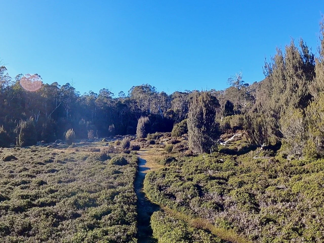
The trails is flat as you leave the carpark, but quickly turns uphill, with the bulk of the elevation at the start of the walk between the carpark and the plateau. It is about a 3km walk from the trail head to the start of the Blizzard Plain, with about 400m in elevation gain, which took us 1½ hours.
In contrast, the Blizzard Plain provides much easier, flat, walking through to Lake Bill. It only took us about 30 minutes to cover the approx 1km across the plain, which actually sees a slight overall drop in elevation.

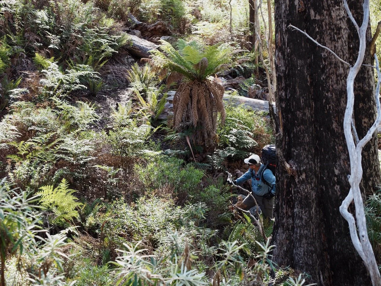
From Lake Bill the track re-enters the forest through to where it crosses Jacksons Creek (the outlet creek from Lake Myrtle). This next section took up about 40 minutes, and while the overall change in altitude was negligible, it involves a bit of up and down.
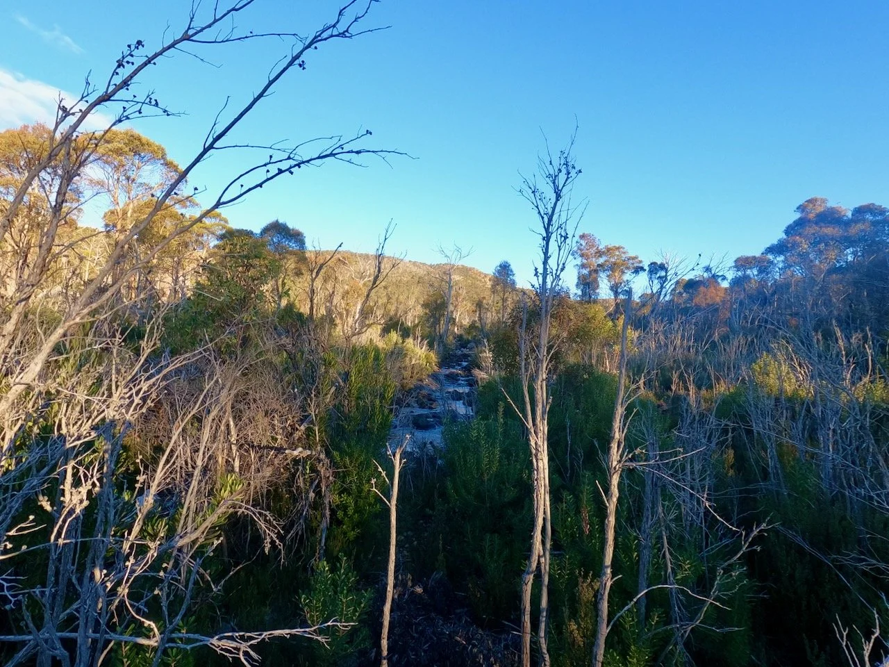
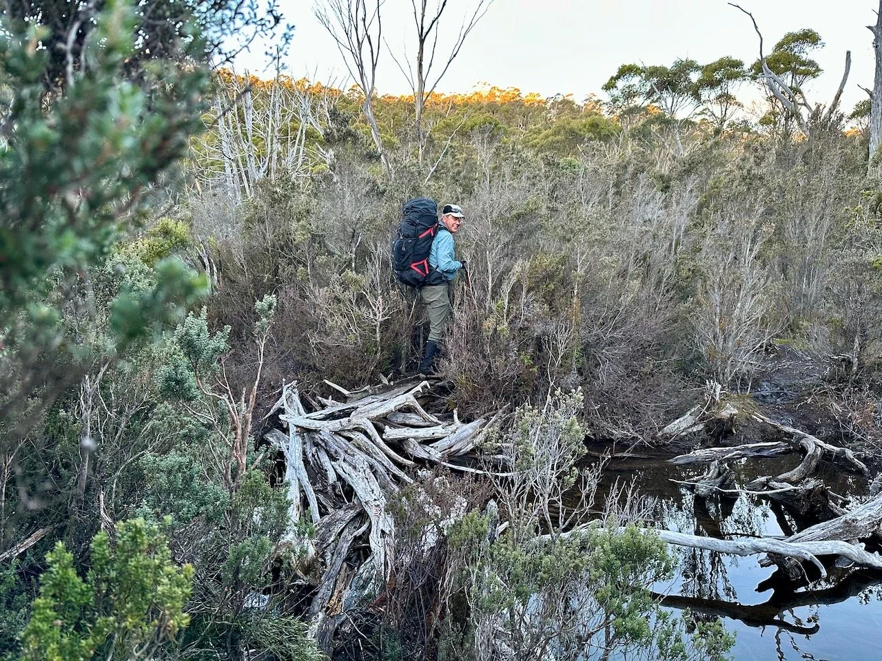
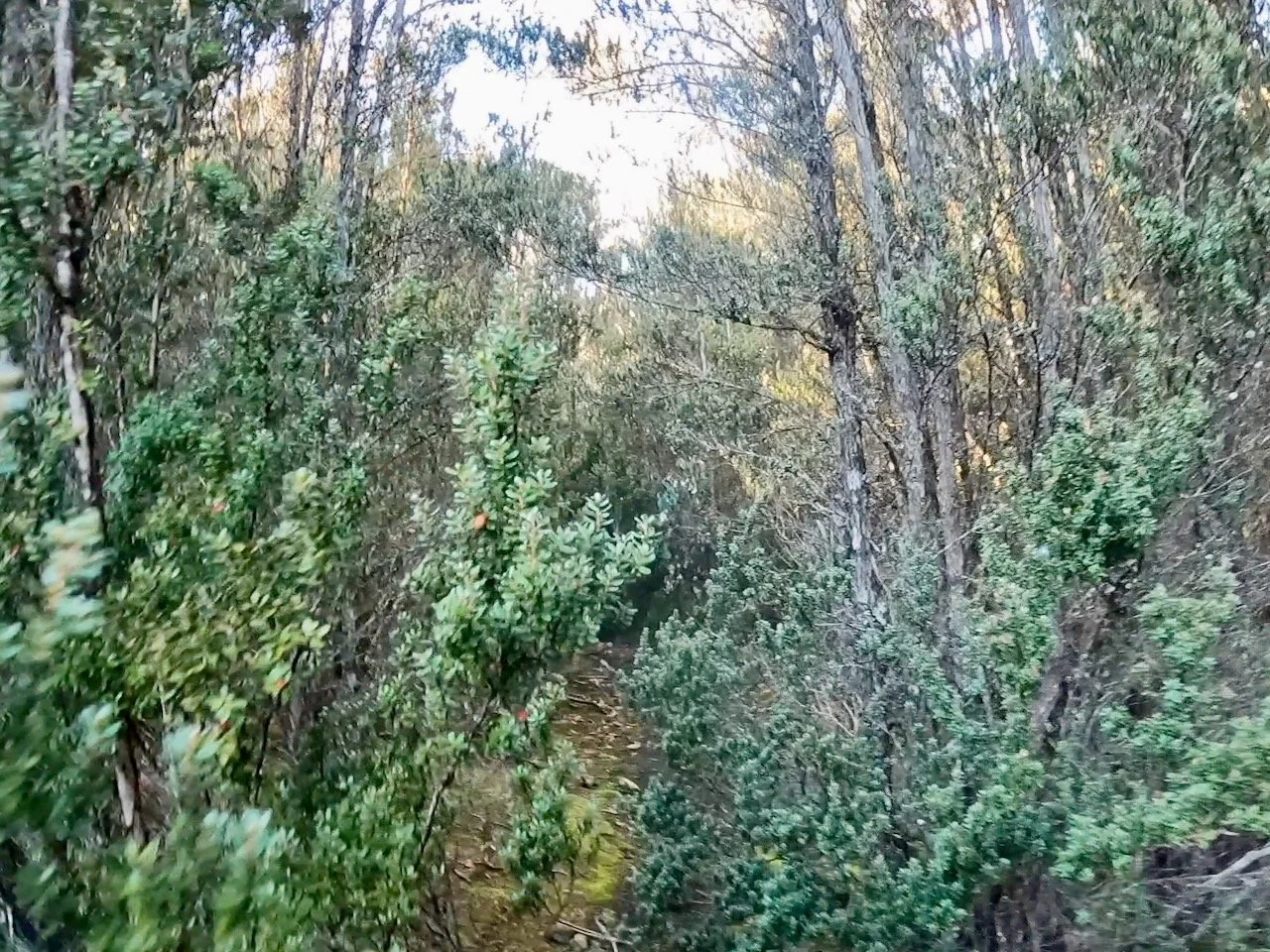
After crossing Jacksons Creek, the vegetation turns to scrub. It took us just under an hour from here to reach our camp site at Lake Myrtle, which involved another crossing of Jacksons Creek at the point it exits the lake.
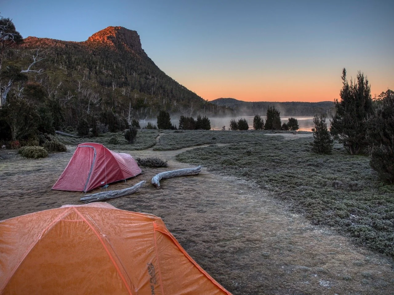
On reaching camp, we quickly put up our tents in the fading light and climbed into bed as the temperature quickly plunged blow zero.
Mount Rogoona
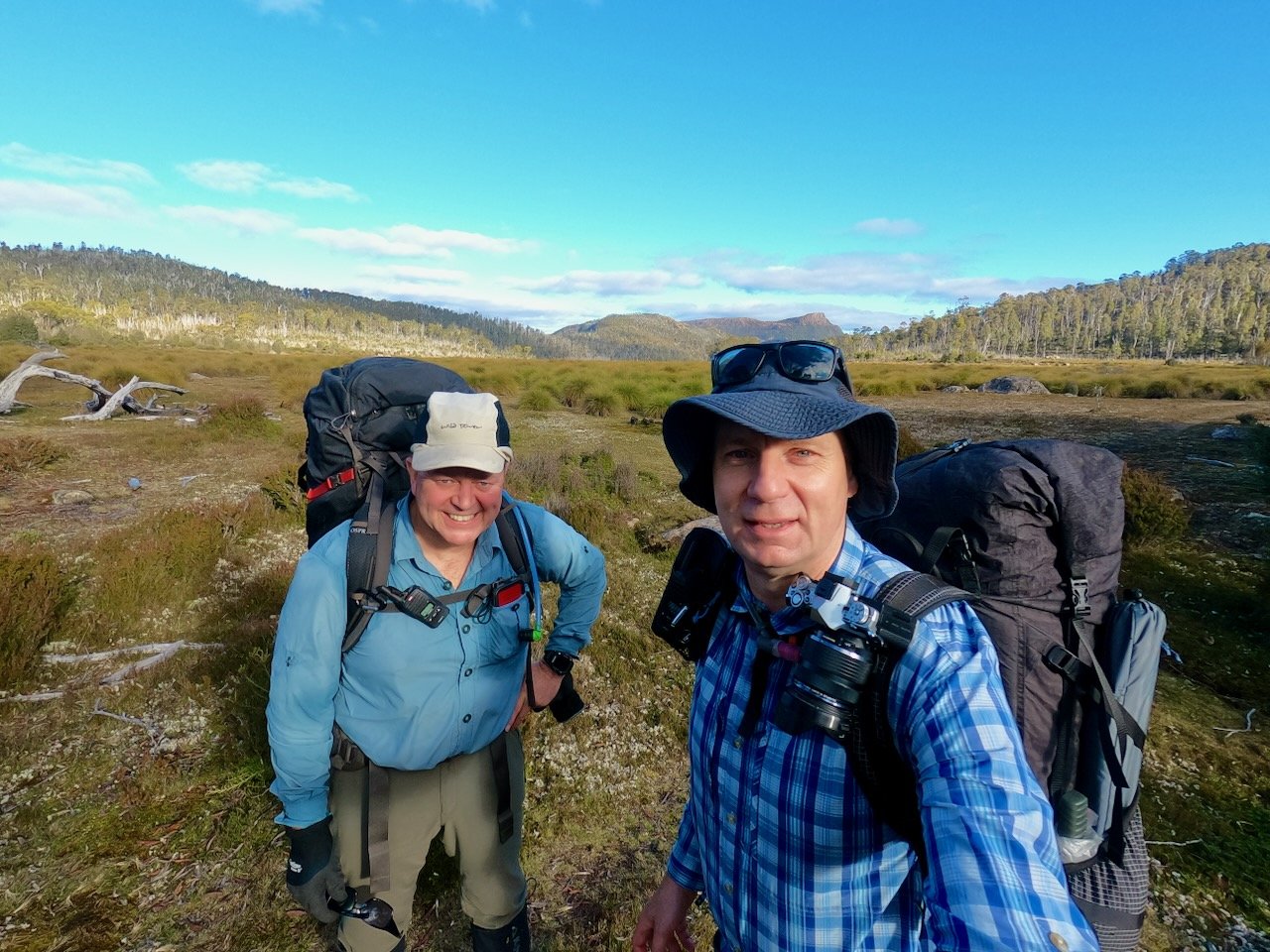
We woke the next morning to blue skies, but stayed in our tents for several hours given the overnight temperature – it was too cold to use our fingers properly until we had the sun shining on us! So, it wasn’t until about 9:20am that we finally headed out to climb Rogoona.
Our plan this day was to climb Rogoona, and then after returning to camp, relocate our camp site to Junction Lake, ahead of climbing Mountains of Jupiter the next day. AllTrails advises the return hike to summit Rogoona from the lake is 2¼ hours, but somehow we took over 6 hours to complete this (including breaks / lunch).
We set off continuing along the Lake Myrtle Track, that we had come in on, towards Lake Meston. Initially this was open near where we camped, but soon re-entered the scrub, with a little bit of scrambling up some rocky sections.
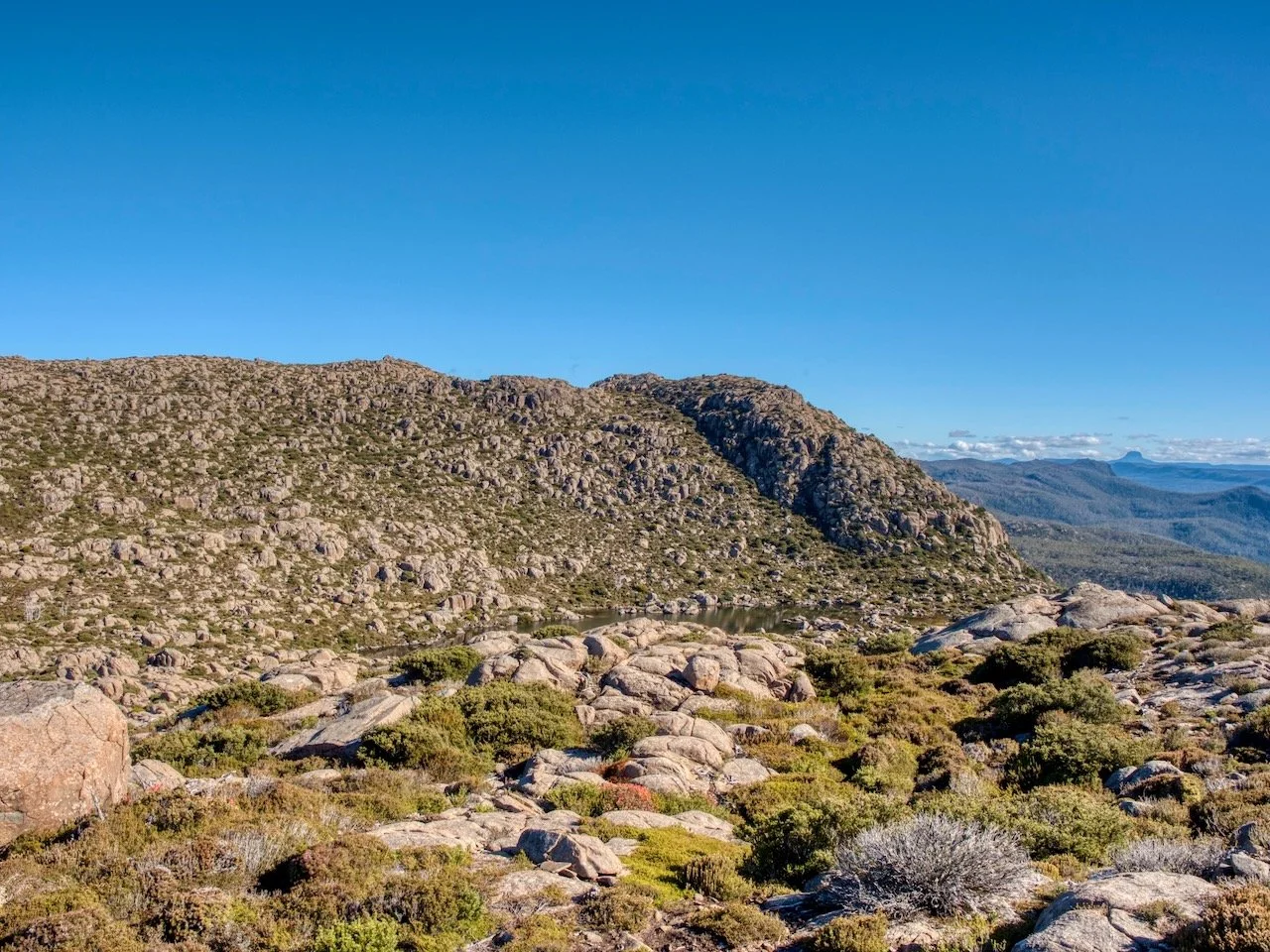
After about 10 minutes or so we arrived at a rocky shelf that overlooked a glistening tarn to our northeast that was still frozen over.
This was the point at which we departed the Lake Myrtle Track and headed south on the untracked route to summit Mt Rogoona. After a little bit of searching, we found the cairns that lead us away from the main track. The route quickly started climbing towards a ridge line we’d have to traverse to make our way to the summit. Not having read the map closely, we assumed this was the high point above our camp site.
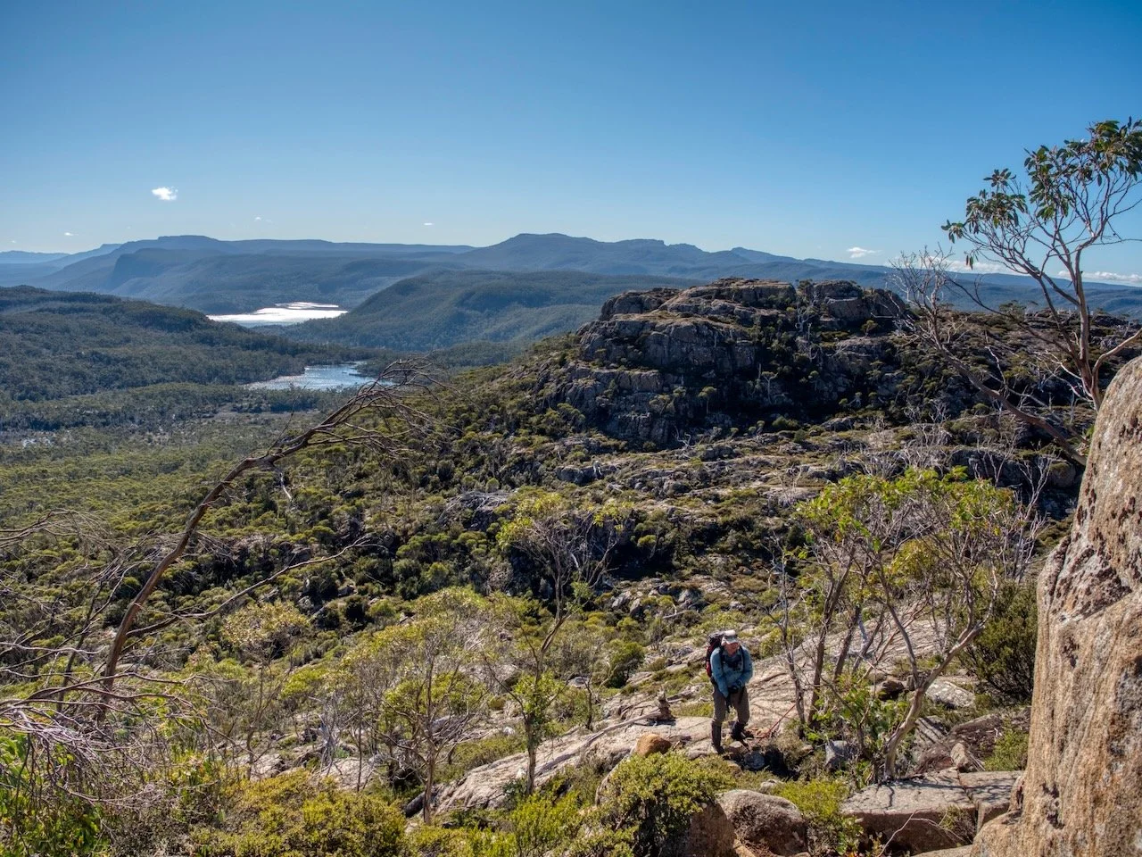
As we climbed we could see Lake Poa behind us, and beyond that what I assume is the southern end of Lake Louisa. It took about an hour to reach a point where we had some more vertical climbing up to the top of the ridge.

After a short scramble we reached the top of the ridge line. From here we turned east, towards what we assumed was the summit (at the righthand end in the below photo). This involved traversing the bouldery ridge line, with the only vegetation being low ground coverings. It soon became clear that we would have to descend into a valley between our ridge and the summit and then start climbing again, over very similar ground.
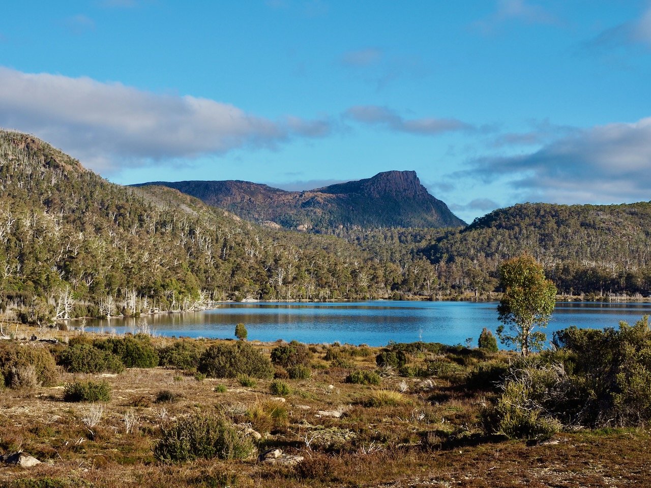
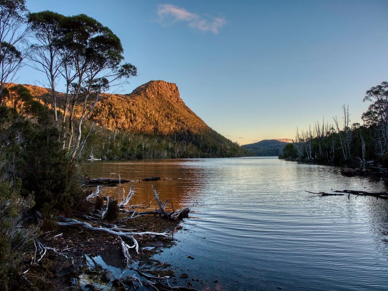
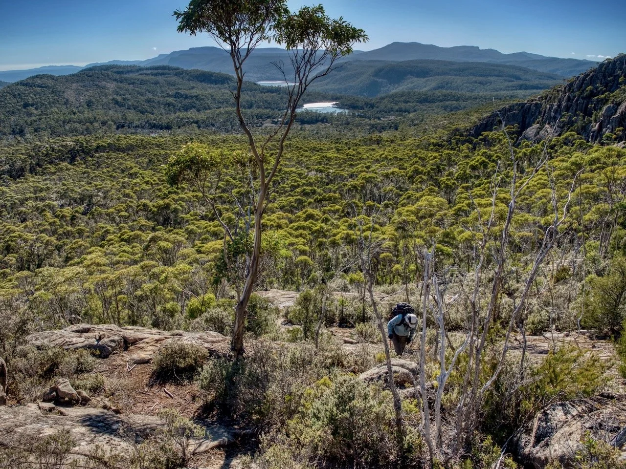
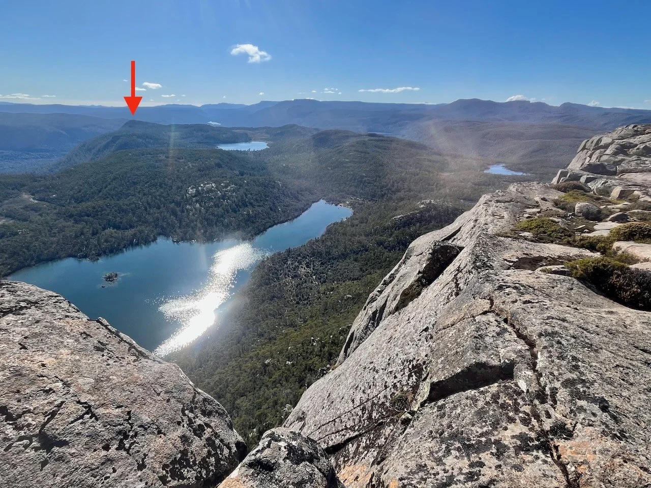
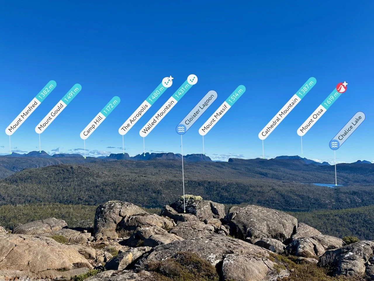
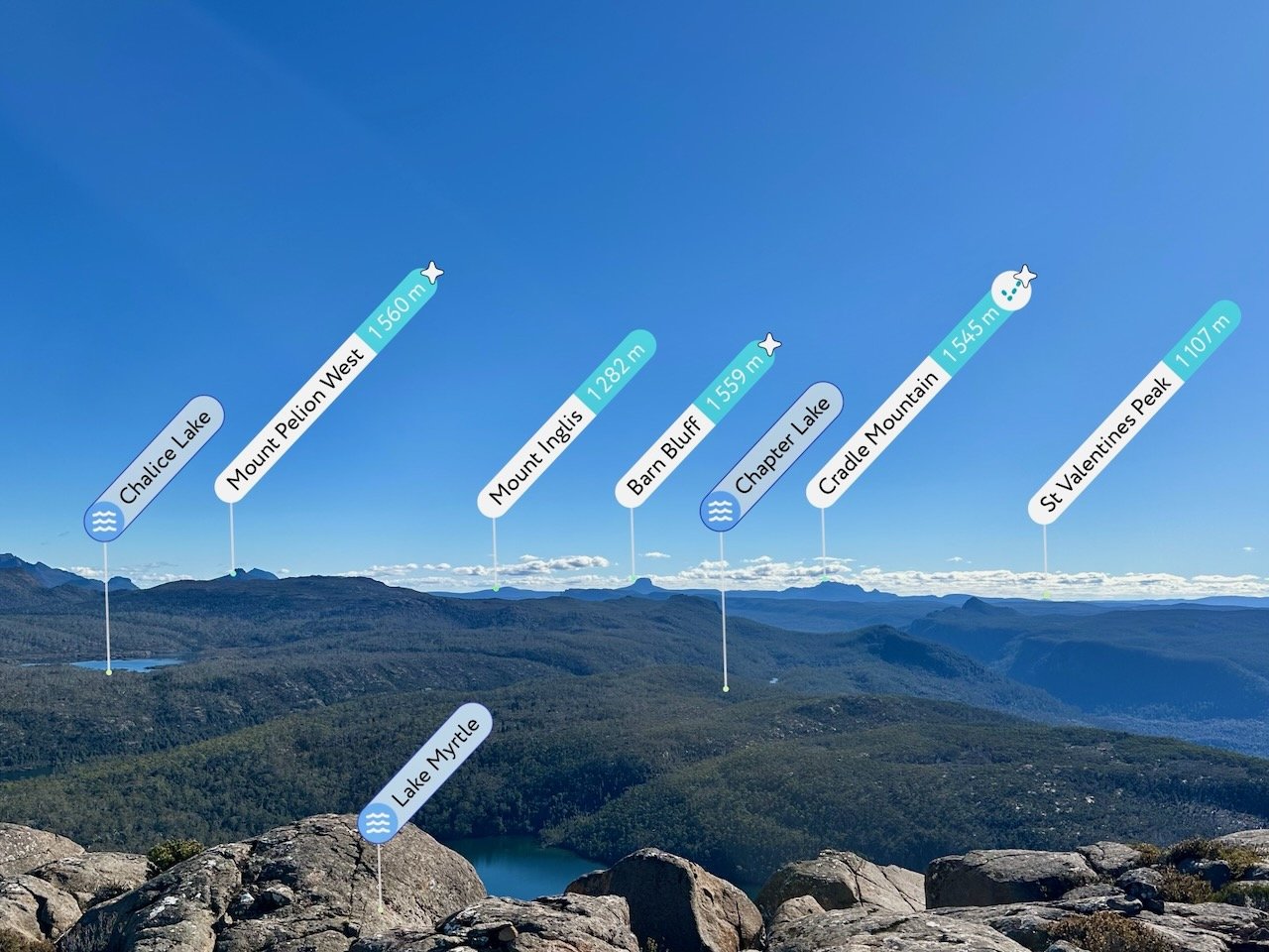
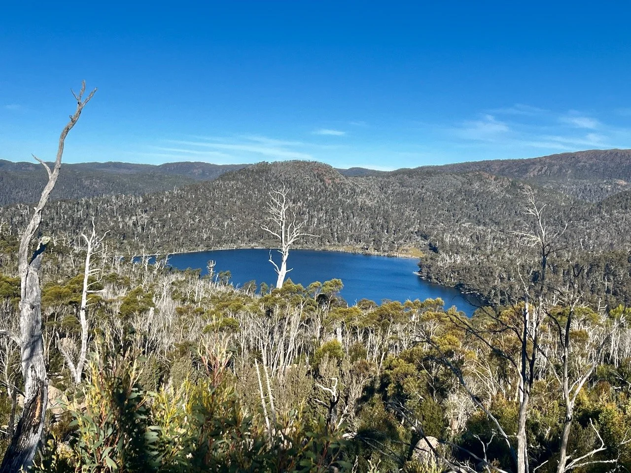
We reached our assumed summit about 2½ hours after we had set off, with amazing views of Lake Myrtle, our future target Nescient Peak (↓), and our campsite, below us.
With no obvious summit cairn, a quick map check showed that we weren’t at the summit and that it was further to our south. However, we were grateful for the cairned route that had led us to this point and its magnificent views.
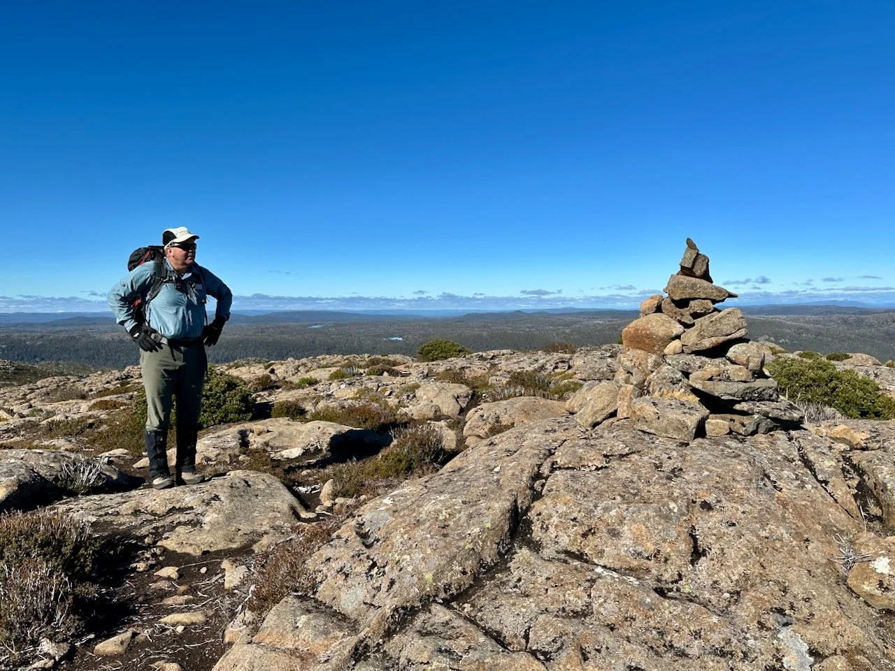
After another 30 minutes (a bit over 3 hours from when we had set off), and 700m of walking, we reached the actual summit, which was marked with a large cairn, and gave amazing views of the surrounding mountains.
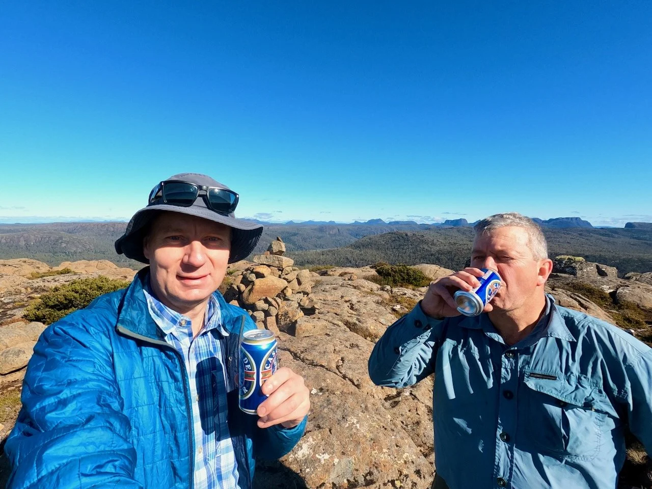
After some lunch on the summit, it was time to head back to camp. Instead of retracing our steps the north, we set off to the northeast cutting across to our climb down, saving us a little bit of time. The route wasn’t marked, but the summit terrain was easy to navigate through. At the top of the ridge we rejoined our original route in and continued back to camp, getting back there 6 hours after we had departed.
With only a couple of hours of daylight left, we abandoned plans to continue into Junction Lake and spent that night at Lake Myrtle.
Nescient Peak
Not having gotten to Junction Lake the day before, we contemplated if we wanted to add an extra day to our trip. But given the short days, and how much time we were spending in the tent, we decided to skip on our plans of summiting Mountains of Jupiter this trip, and instead headed back to Nescient Peak, which we had passed on the way in.
We didn’t end up leaving Lake Myrtle, after packing up camp, until 11:20am. We set off, retracing our steps towards the car, taking about 1½ hours to a spot on the Lake Myrtle Track where we decided to go off track to summit Nescient Peak. Unfortunately, on the way in, we’d completely missed an obviously cairned point where we should have departed the track. Not having seen that, and not having come back quite that far, we assumed the route was completely untracked.
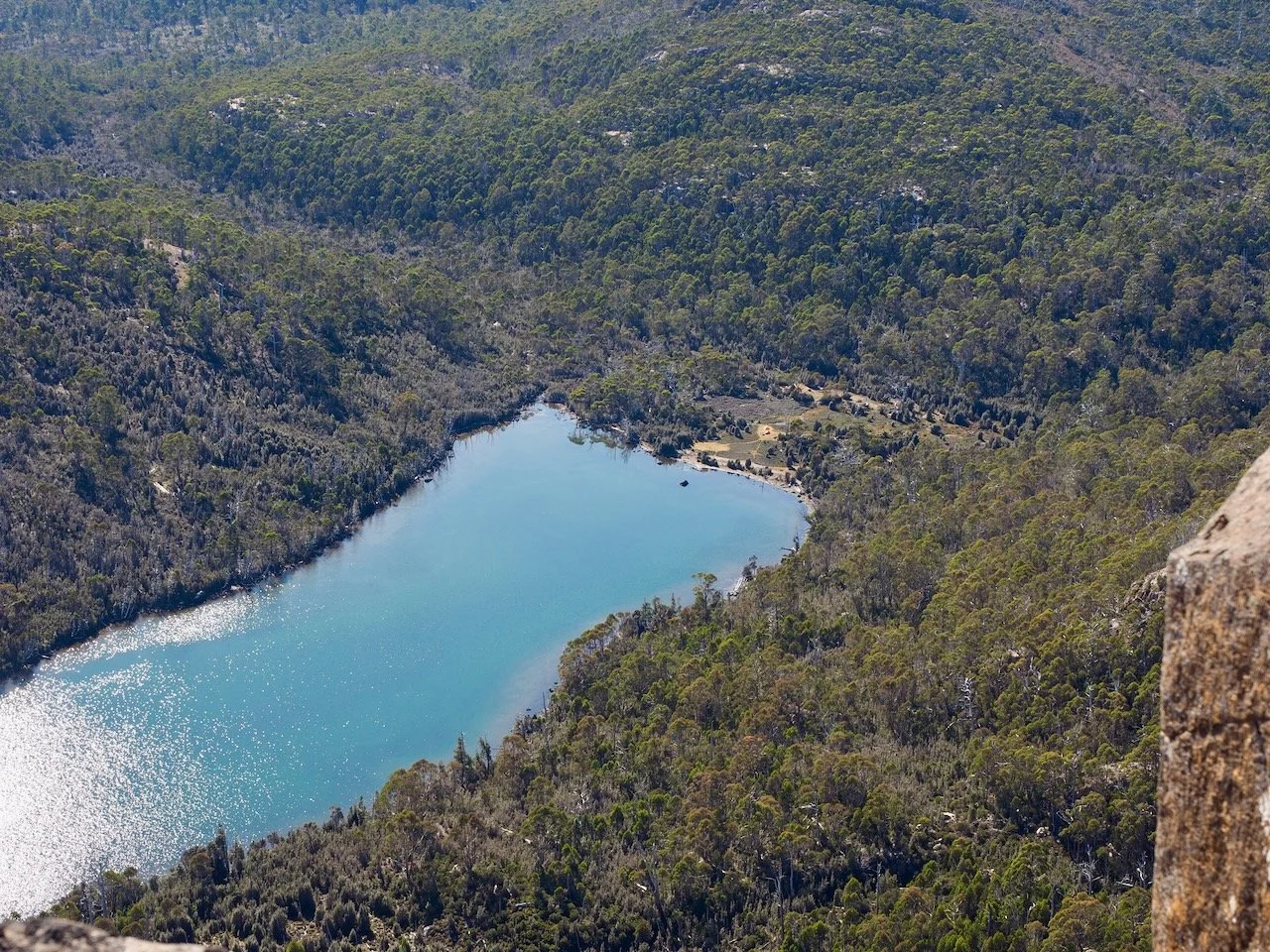
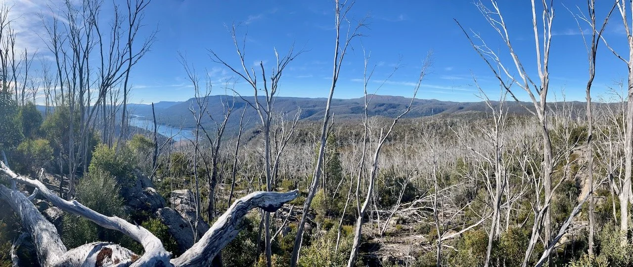
As it turned out, while not marked, the route we took in from the southern point on the Lake Myrtle Track was in fact a gentler climb than the cairned route. Luckily, after only about 15 minutes of climbing, we found ourselves on the cairned route and followed it the rest of the way to the summit. The route was mostly through scrub or open forest, so didn’t provide much in the way of views, however there was a vantage point that provided a good view over Lake Bill.
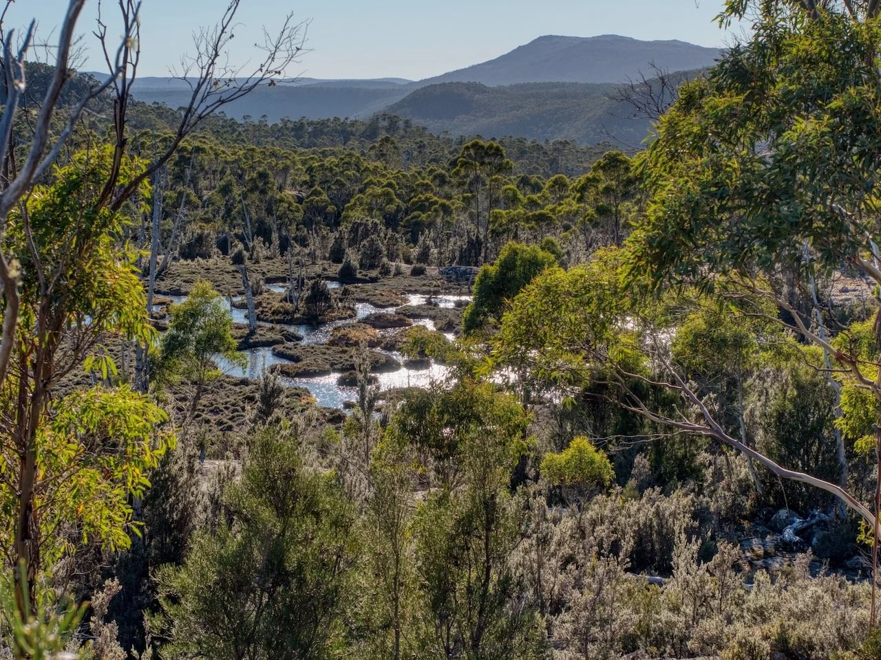
Lake Bill
The climb only ended up taking us 40 minutes to reach the summit, being about 3km from where we had departed the Lake Myrtle Track. There was a short section of scree towards the summit, but otherwise the route was relatively straight forward.
The summit itself was relatively scrubby, so didn’t offer amazing views, however we could see Western Bluff, beyond Lake Rowallan to our north, and the main section the Walls of Jerusalem to our east.
After a quick lunch break on the summit, we followed the cairned route back to the Lake Myrtle Track, collected our packs from where we had left them, and returned to the car, having spent three fabulous days back in the Walls of Jerusalem National Park. However, with Mountain of Jupiter eluding us a second time, I’m sure it won’t be long until we return!